Routes that fight the wind so you don't have to

Tell it how far you want to ride and when you are setting off. Wind Ride reads the forecast for that hour and that place, and plans a loop around it. Built for the road bike, free, and the GPX goes straight to your Garmin.

The problem

On a flat, open ride the wind is the hill

An out-and-back that felt effortless on the way out turns into forty minutes of grinding on the way home, and nothing on the map warned you — the map does not know which way the air is moving. Wind Ride does, and it plans accordingly.

Headwind firstBalancedTailwind first

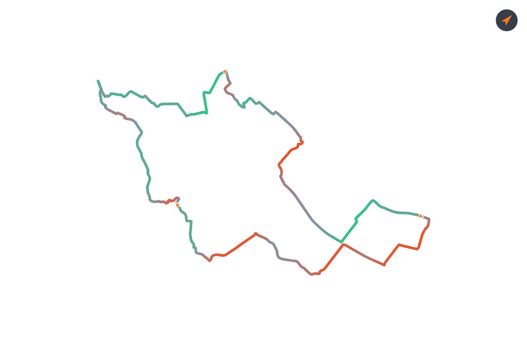
Balanced — 48.2 km, and the fastest of the three

A 48.2 km loop from Utrecht that crosses the wind in both directions rather than committing to either end.

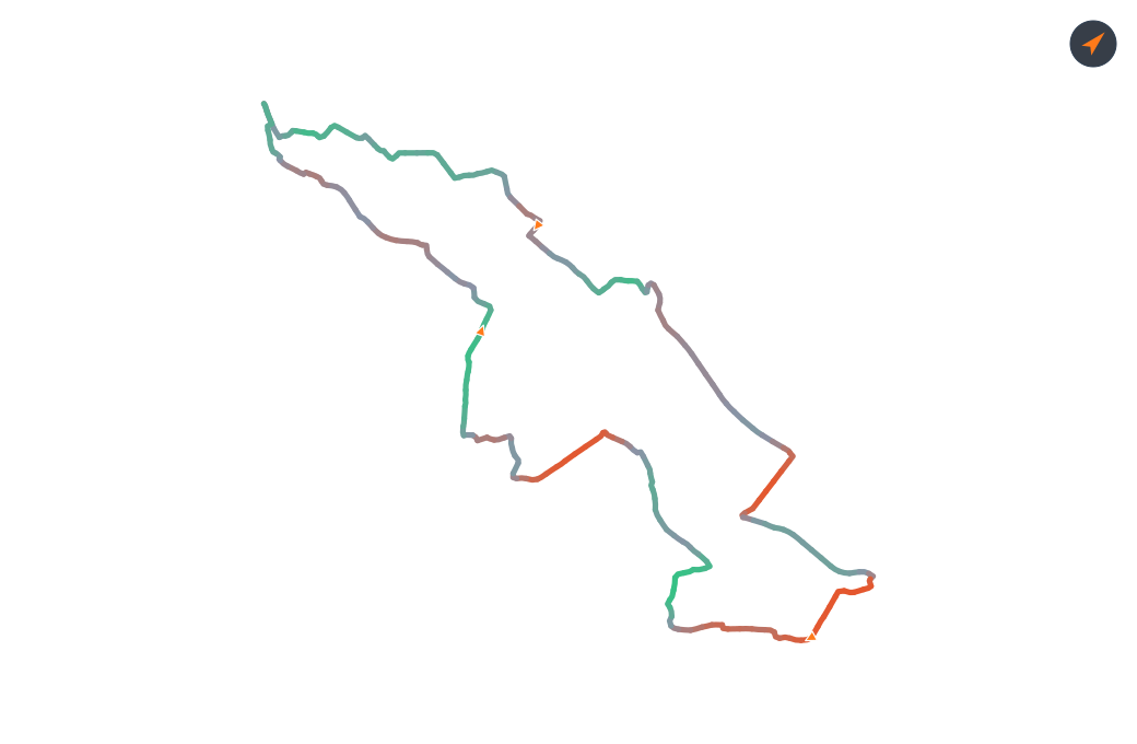
Grind out, fly home

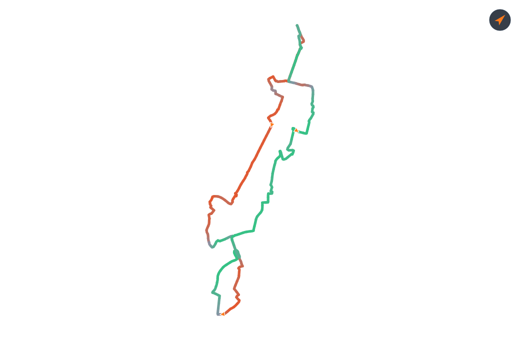
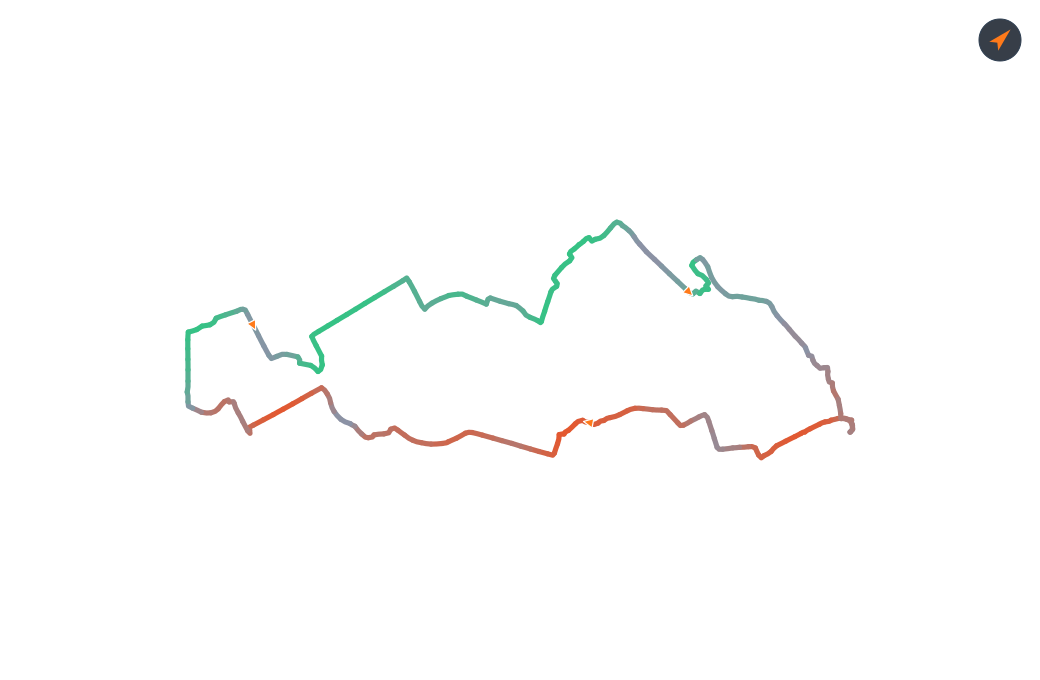
A 39.4 km loop running south-west out of Utrecht into the wind, then home with it behind you.

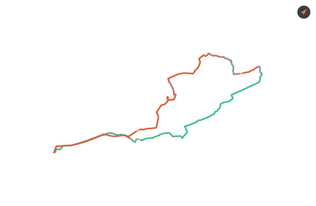
Fly out, grind home

A 43.2 km loop running north-east out of Utrecht with the wind, then back into it.

How it works

Seven steps, about a minute

  1. Set a distance. How far you want to ride, in kilometres. The loop is built outward until it has spent half of that, then turned for home — ask for 45 and you get close to 45, not a wander out to 60.
    Distance
    45607590100km
  2. Set a start time. The forecast is read for the hour you are actually riding, from the point you are actually leaving — not for the day in general. A 07:00 start and a 17:00 start on the same day can produce completely different loops.
    Start time
    0709131719:0015304500
  3. Set your average speed. This decides where on the map you will be at each hour, so the wind is read for the time you actually reach each stretch rather than the time you set off. On a long ride the difference is a whole weather window.
    Avg speed (km/h)
    2830313234km/h
  4. Say what you want to ride on. Three switches, all off by default: keep out of town centres, skip ferry crossings that may not be running, and steer around klinkers and poor surfaces.
    Surfaces
  5. Generate. Wind Ride builds the loop in both directions, scores each against the wind along its whole length, and keeps the better one. Ask for three alternatives at once and it returns three genuinely different shapes to compare.
    Generate
    Generate route
  6. Shape it, if you want to. Drag the line anywhere on the map and only that stretch reroutes — the rest of your ride is untouched. Add waypoints to send it past somewhere specific, and undo if a drag went somewhere you did not mean.
    Drag to reshape
  7. Download the GPX. Straight into Garmin, Komoot, or wherever you plan from. Every ride you save stays in your Downloads page to fetch again later, and a share link hands someone the shape and the numbers without your name or your address.
    43.2KM
    distance
    +6.41
    wind score
    1h29
    est. time
    Download GPX

The choice you actually have

Choosing where the hard part goes

A loop comes back to where it started, so whatever the wind gives you one way, you pay for the other. What you can choose is when. Slide the wind strategy one way and you meet the headwind early, while you are fresh, and ride the tailwind home. Slide it the other and the tailwind comes first.

The ends of that slider go a long way — far enough for an almost pure downwind half, or a deliberate headwind session if that is the training you came for. The middle is Balanced, and honestly it is the fastest setting overall. The slider chooses when the hard part comes, not whether it comes.

Grind out, fly home: a 42.3 km loop from Utrecht, coloured by wind effort.
Easier finish: a 47.5 km loop from Utrecht, coloured by wind effort.
Balanced: a 48.2 km loop from Utrecht, coloured by wind effort.
Harder finish: a 54.5 km loop from Utrecht, coloured by wind effort.
Fly out, grind home: a 45.6 km loop from Utrecht, coloured by wind effort.

Same start, same hour, same wind, and the same 45 km asked for — only the dial moves.

Basemap © CARTO, data © OpenStreetMap contributors

What else it does

The rest of it

Where it works

The Netherlands, and built for it

Flat, open, windy, and mapped in extraordinary detail by OpenStreetMap contributors. Routing runs on a self-hosted BRouter; wind and weather come from Open-Meteo.

What it costs

Nothing

There is no paid tier and no advertising. The server and the forecasts behind every route do cost real money each month, so there is a tip jar inside the app — entirely optional, and nothing about the app changes either way.

One thing said plainly: a generated route is a suggestion. It will warn you about road works that have been reported, but not about the ones nobody reported, and never about the ice or the lorry. You are riding it, so you judge the conditions on the day.

Try it

Making an account takes a minute and needs an email address, so the rides you save have somewhere to live.

Plan a ride

Free. No card, no advertising, no selling anything on.

WindRide is also on Strava and WhatsApp

Join the Strava club and share your WindRide experience with fellow road cyclists, help WindRide grow by offering feedback, or just follow the club and WhatsApp channel to keep track of WindRide updates and new features.